In 1912 the Titanic sank. Due to technological limitations and high costs, it took scientists more than 70 years to find the wreckage. It’s easier these days. We’ll show you where the Titanic is and how you can find it on Google Maps.
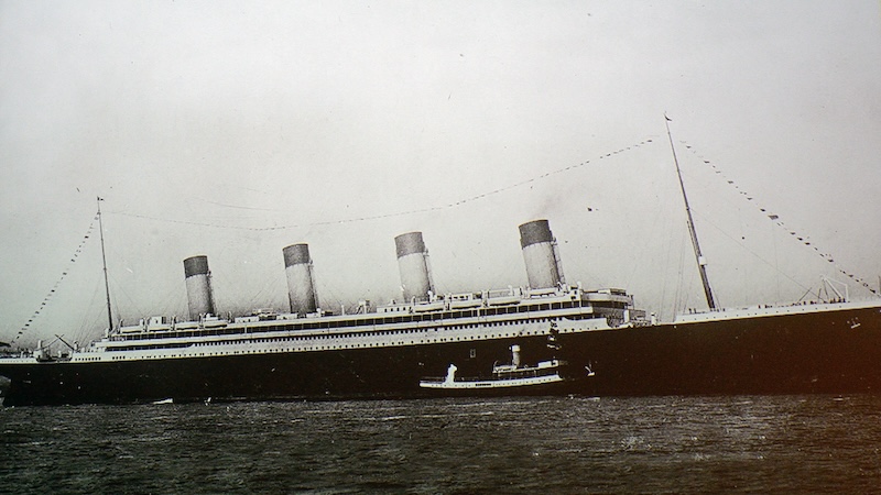
On April 14, 1912, the British passenger ship RMS Titanic struck an iceberg in the North Atlantic. More than 1,500 passengers and crew died in the collision. Even more than 100 years after the ship sank, the fascination and interest in what happened is still great.
Sinking of the Titanic: What happened back then?
The RMS Titanic was on its maiden voyage from Southampton, England to New York City when the collision occurred. The largest ship in the world at the time had almost reached its destination. The Titanic sank just 715 miles from Halifax Harbor in Canada and just 1,250 miles from New York City. She had less than three days left at sea.
The incident made her one of the most famous ships in history. Since then, many secrets, myths and conspiracy theories have surrounded the events of that night. The exact location of the accident remained a mystery for a long time.
It was only 70 years after the collision that an expedition led by Robert Ballard found the wreck of the Titanic on September 1, 1985. The fact that the search took so long was not only due to the ship’s difficult situation. It is located at a depth of about 3,800 meters in the North Atlantic, about 600 kilometers southeast of Newfoundland. The exact coordinates of the sinking were also not known because navigation technology at the time was not precise enough.
Overall, people were extremely limited in their search: the technology for searching and exploring the deep sea was not yet very well developed. There were no sonar or underwater cameras to help locate the wreck. This made the search extremely complex and expensive. It is now much easier to find the shipwreck.
On Google Maps: Where is the Titanic?
Because these days all you need is access to the internet to locate the Titanic. Simply enter the following coordinates via Google Maps or Google Earth: 41.7325°N, 49.9469°W.
Now you can explore the area where the iceberg was when the Titanic collided with it. The exact location of the sinking is media reports about 21 kilometers from the inaccurate coordinates given by the Titanic’s radio operators on the night of the accident.
Tourist diving trips to the wreck of the Titanic have also been taking place for around two decades. However, those interested have to do this $250,000 pay. In June 2023, the five occupants of a submersible that was supposed to take them to the wreckage of the ship died on one such trip.
Also interesting:
- Activate Google Maps location history – you’ve already been to these places
- Google Maps error causes traffic jams that stretch for miles
- Science: New technology translates thoughts into text
- Google Chrome: This is how you can have texts read to you
The article Where is the Titanic? How to find them on Google Maps by Beatrice Bode first appeared on BASIC thinking. Follow us too Facebook, Twitter and Instagram.
As a Tech Industry expert, I would say that using Google Maps to locate the Titanic is a fascinating application of technology. The sunken ship is located in the North Atlantic Ocean, approximately 370 miles off the coast of Newfoundland, Canada. By using Google Maps, users can explore the site of the Titanic wreck and gain a better understanding of its layout and condition.
However, it’s important to approach this search respectfully and with an understanding of the significance of the Titanic disaster. The shipwreck is considered a grave site and should be treated with the utmost respect. Using technology to explore the wreck can offer valuable insights and help to preserve the memory of the tragedy, but it should be done in a responsible and ethical manner.
Overall, using Google Maps to find the Titanic is a powerful example of how technology can be used to explore and understand historical events. It’s a reminder of the importance of preserving and learning from the past, even in the depths of the ocean.
Credits